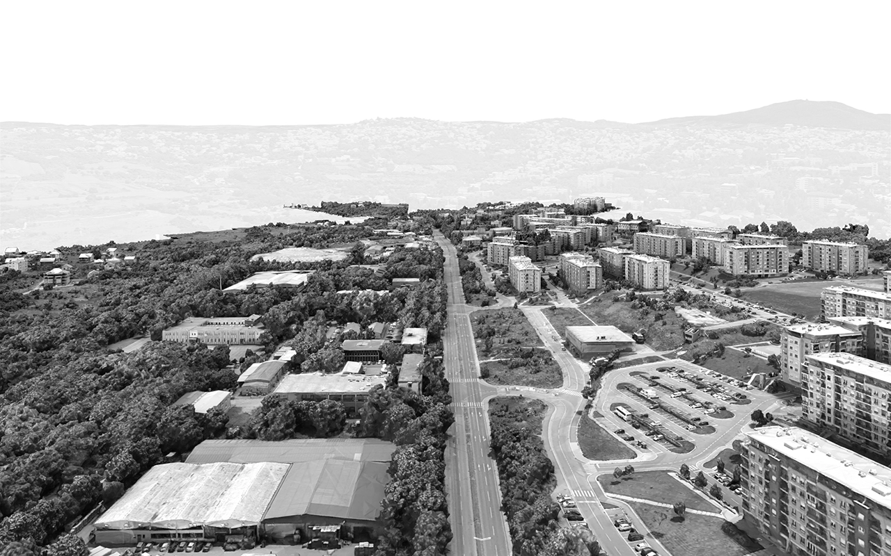
Before
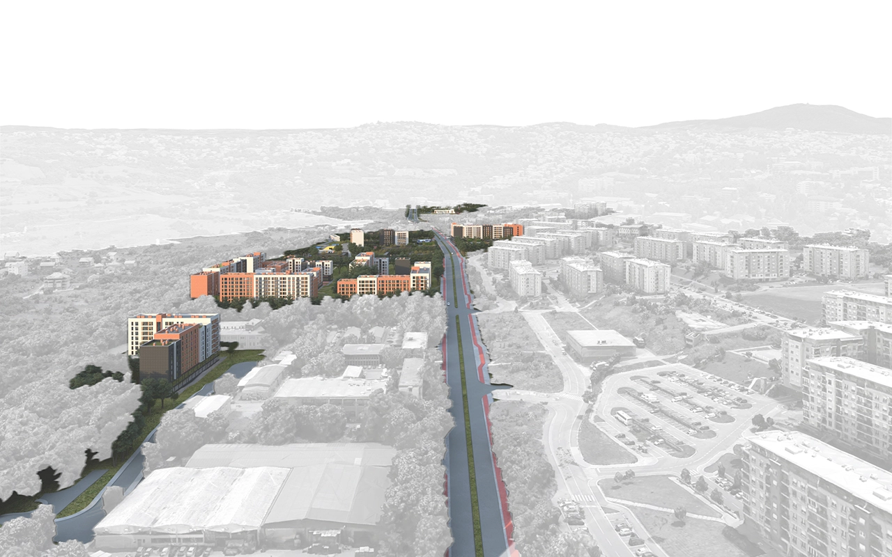
After

.svg)


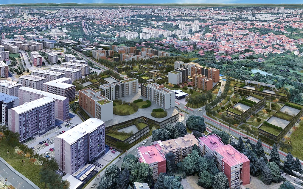
The territory covered by this Plan occupies an area of approximately 32.77 hectares, within the cadastral municipalities of Vozdovac and Kumodraz. The planning area is located between the Stepa Stepanovic residential settlement, the Kumodraz Stream, and the planned SMT road, extending from Borska Street to the Lasta interchange. Situated at the transition between the already developed urban fabric and the city’s peripheral zone, the area requires a detailed spatial and functional integration into the urban structure of Belgrade. One of the main objectives of the Plan is the transformation of the existing industrial zone into a mixed-use area combining residential, commercial, and service facilities. The process of defining the final land-use concept included a comprehensive contextual analysis—covering urban typology, traffic structure, green spaces, and social infrastructure facilities. The Plan defines new land uses, while also integrating relevant elements from existing valid plans in the surrounding area. As part of the planning process, a Strategic Environmental Impact Assessment was also conducted, evaluating the ecological implications of the proposed development.
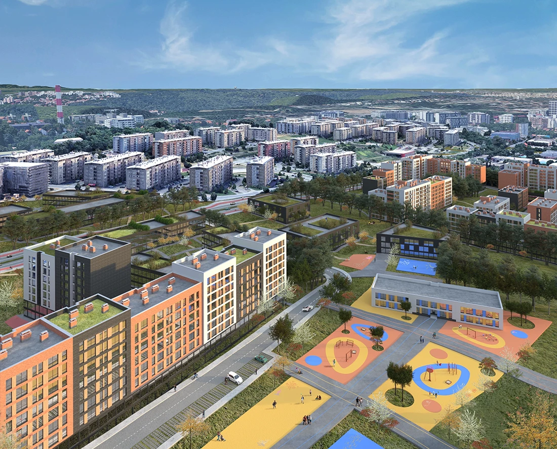

Given that one of the key goals of the Plan is the transformation of the existing industrial zone, the Greenery Analysis was introduced as an essential tool for ensuring environmental protection and enhancement of ecological values. The main sources of environmental pollution in the area were identified as high-intensity traffic roads, primarily Bulevar Peka Dapcevica, as well as existing industrial zones. Additionally, the area along the Kumodraz Stream was identified as being susceptible to erosion. The analysis included mapping and categorization of existing vegetation, recording both individual and grouped specimens according to their type and ecological quality. Existing low and medium vegetation, as well as tree lines, were identified as elements contributing to the landscape character of the site. The results of the vegetation valorization served as the basis for defining a network of existing and planned green areas, categorized as: Public green areas, and Green areas within other land-use zones (residential, commercial, and industrial). The planned green areas have a multifunctional role—to mitigate the negative impacts of traffic and industrial activities, and to improve the microclimate and overall living quality. Tree-lined streets are planned along all new roads to absorb noise and air pollution, while park-like squares are proposed at locations where valuable groups of existing high vegetation have been identified. Special emphasis is placed on the Kumodraz Stream corridor, where the formation of a protective green belt using native plant species is planned to reduce erosion risk. Within commercial, industrial, and mixed-use zones, mandatory landscaping of free surfaces is prescribed, including the use of semi-permeable pavement materials on open parking lots, enabling natural water infiltration and reducing surface runoff and pollution.


