
Before
After

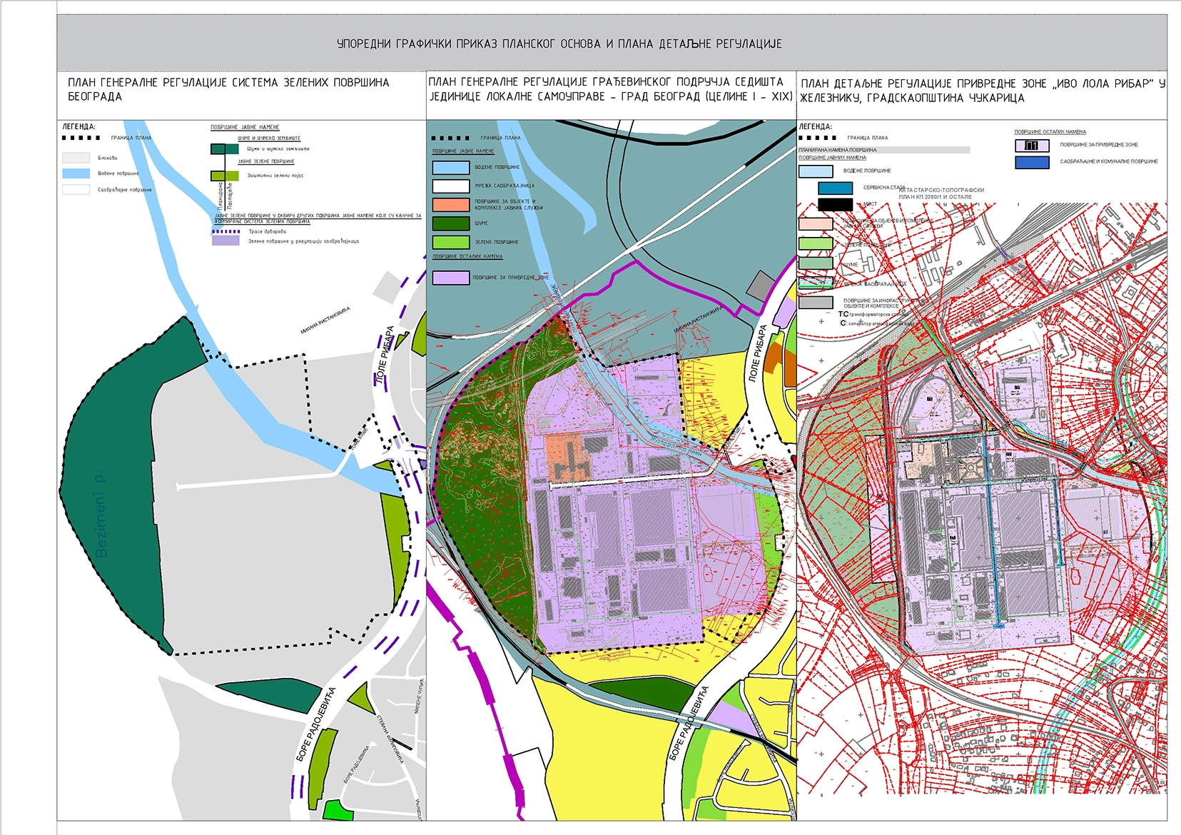
The planning document outlines areas designated for public and other purposes. Public-purpose areas include the road network, water surfaces with service paths and a bridge, areas for public service buildings and complexes – the Technical School Zeleznik, green areas, forests, and areas for infrastructure facilities and complexes – a stormwater separator and a transformer station. Areas for other purposes include industrial zones P1, as well as traffic and utility areas that serve as access roads within the complex. Within the P1 industrial zone, activities from classes A, B, and V are permitted. It is possible to construct buildings intended for production and construction plants, warehouses, industrial zones, goods and transport centers, and research complexes. Additionally, commercial facilities are allowed on up to 30% of the area designated for industrial activities. The plot construction index is 1.0, while the maximum permitted building cornice height is 18.0 m. The minimum percentage of open and green areas on the plot is 20%, of which at least 10% must be unpaved green areas. Within the zone, the construction of detached, single-sided, and double-sided attached new buildings is permitted. Existing buildings may be reconstructed, extended, or upgraded within the permitted urban parameters and building regulations.

.svg)


The subject Plan encompasses the industrial zone of the former "Ivo Lola Ribar" factory in Zeleznik, along with the surrounding area between the bypass road, the railway, the planned road 1-1, and the Zeleznicka River, including connections to existing and planned infrastructure. Following the privatization of the former "Ivo Lola Ribar" factory complex, the separation of individual companies was not fully implemented in a way that would allow them to function independently. The former complex also included a vocational high school, which is still located on the site. Additionally, in the western part of the location, there is an informal landfill. One of the goals of the Plan is to designate areas for the construction of transportation and utility infrastructure, in such a way that each newly formed building plot represents part of a functional whole.