

Before
After
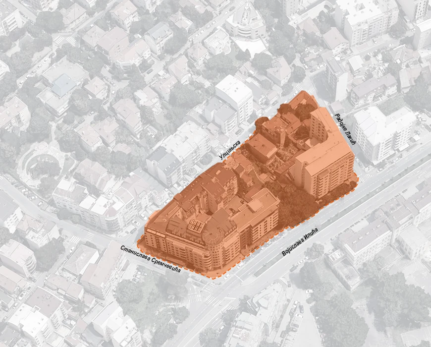
The area within the plan boundary is bordered on the southwest by Vojislava Ilića Street, classified as a primary (first-order) street; on the west by Stanislava Sremčevića Street, classified as a secondary (second-order) street; while Ulcinjska and Radojke Lakić Streets form part of the secondary street network. Other infrastructure systems — including water supply, sewage, electricity, telecommunications, gas, and district heating — have been coordinated in accordance with the overall planned capacities.

.svg)


The subject plan covers a part of the Zvezdara municipality territory, enclosed by the streets Ulcinjska, Radojke Lakić, Vojislava Ilića, and Stanislava Sremčevića. The primary goal of this plan is to optimize land use and ensure more efficient utilization of the available building space, in compliance with the parameters set by higher-level planning documents. To that end, the plan proposes transforming areas currently designated for other uses — residential and commercial — into mixed urban center zones and residential areas.

The plan includes the following land use zones: a Mixed Urban Center Zone with higher building heights (M4) and a Transformation Zone for converting family housing in partially formed urban blocks into multi-family residential buildings (S6). Within the M4 zone, three subzones are defined: • M4.1, located along Radojke Lakić Street, • M4.2, the subzone of existing buildings, • M4.3, adjacent to Vojislava Ilića Street. The maximum allowed plot occupancy index for all M4 subzones is 60%, with a possible increase of up to 15% for corner plots. The minimum required open and green space on the plot is 40%, or 31% for corner plots, with at least 15% of green areas in direct contact with the ground. Maximum permitted building heights are 26 meters in M4.1 and 32 meters in M4.2 and M4.3. Ground floors in all subzones are required to include commercial spaces. Compatible commercial uses may occupy up to 10% of the plot area.


